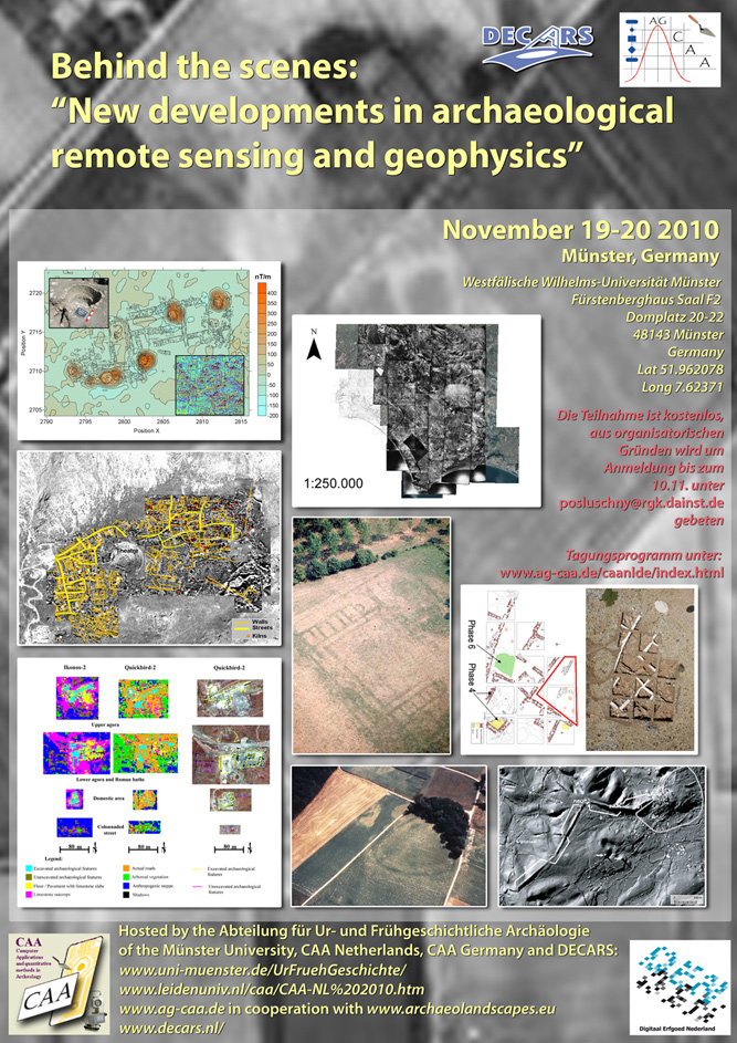
1. Niederländisch-Deutsche Tagung der CAA Die AG "Computeranwendungen und Quantitative Methoden in der Archäologie" (CAA Deutschland) hat vom 19.-20.11.2010 zusammen mit der niederländischen CAA, dem "Dutch Expertise Centre for Archaeological Remote Sensing" (DECARS) und der Universität Münster (Abteilung für Ur- und Frühgeschichtliche Archäologie) zum ersten Mal eine gemeinsame Tagung mit dem Titel "Behind the scenes: New developments in archaeological remote sensing and geophysics" veranstaltet. Bei der Veranstaltung wurde mit Vorträgen in englischer Sprache ein repräsentativer Überblick über die aktuellen Entwicklungen im Bereich von Fernerkundung, LiDAR, Geophysik und ähnlicher Verfahren gegeben, die in den letzten Jahren und Jahrzehnten entscheidend zum Erkenntnisgewinn in der Archäologie beigetragen haben. Neben Beiträgen zu verschiedenen Methoden und ihrer Weiterentwicklung und zu Analysetechniken der dabei ermittelten Daten haben auch Fallbeispiele die Möglichkeiten der gezeigten Verfahren illustriert. Den Keynote-Vortrag hielt Prof. Kenneth L. Kvamme (University of Arkansas, USA) halten, der sich schon seit langem mit den erwähnten Verfahren sowie mit GIS-gestützten Untersuchungen beschäftigt. Die Tagung wurde von fast 90 Teilnehmern aus Belgien, Deutschland, Großbritannien, den Niederlanden, Österreich und den USA besucht, die sich rege an den Diskussionen beteiligten. Nicht zuletzt wegen der hervorragenden örtlichen Organisation durch die Abteilung für Ur- und Frühgeschichtliche Archäologie der Universität Münster war die Veranstaltung für alle Beteiligten ein großer Erfolg, der vermutlich 2jährlich wiederholt werden wird. Die Tagung 2012, deren Schwerpunktthema noch nicht feststeht, wird voraussichtlich in den Niederlanden statt finden, nähere Informationen dazu finden Sie dann auf der Internetseite der AG CAA.
|  Die Veranstaltung ist Teil der Aktivitäten des von der EU geförderten ArchaeoLandscape-Netzwerks (http://www.archaeolandscapes.eu) Die Veranstalter bedanken sich herzlich bei den Sponsoren Universität Münster, Abteilung für Ur- und Frühgeschichtliche Archäologie, der Firma Sensys sowie Digitaal Erfgoed Nederland! |

Eine Datei mit dem Programm sowie allen Vortragszusammenfassungen finden Sie hier. Einige der Vorträge sind nach dem Klick auf den Vortragstitel als PDF verfügbar.
Eindrücke von der Tagung sind in einer Fotogalerie verfügbar.
Preliminary programme
Abstracts:
Using GPR for archaeological surveys. How to conduct a state-of-the-art survey (and avoid the many pitfalls) (PDF zum Herunterladen)
GPR has been used in the field of archaeology for many years now. It is a very quick and cost-effective tool for obtaining lots of data and gain more insight in your site. Due to improved hardware, software and computing power, both greater coverage and production of more comprehensible display and interpretation is possible. Therefore with increasing use of GPR and growing familiarity with techniques, it leads to a fertile area for continuing innovation, commercial exploitation and integration with other disciplines. Saricon uses GPR for archaeological and geological surveys, as well as for utility detection and singular metal objects (i.e. UXO’s).
Our view on how to execute a state-of-the-art survey by GPR:
Step 1:
First of all a good preparation (how obvious!)
What are the right questions to ask regarding the aim of the survey, local geology, soil and surface conditions? What system and settings will give us the best quality? History of site? Positioning by GPS or local grid? Define your research goals!
Step 2:
Site assessment, testing equipment and positioning.
Running several test lines to get a ‘feel’ for the location but also get the right settings. Don’t just flick on your equipment and start running along your survey lines!
Step 3:
Processing data. Checking and handling the raw radardata. Using filters to reduce background noise. Building your 3D-model or timeslices. Groundtruthing if necessary.
Step 4:
What am I seeing??
Incorporating other layers of information like results from previous surveys, aerial photography, geological maps, information about corings etc… Discuss model and refine interpretations.
Several examples with very different site conditions / research goals will be shown in our interactive 3D-model and discussed.
Ferry van den Oever
GPR-operator
SARICON
Industrieweg 15
2995 BE Heerjansdam
The Netherlands
FvandenOever@saricon.nl
Three-dimensional underground – The application of ground-penetrating radar in archaeology
Ground Penetrating Radar (GPR) investigates reflection characteristics of a given material being under the influence of electromagnetic energy waves. The fundamental properties of the respective medium – in archaeology: the underlying soil and all objects included – are the electrical conductivity and the magnetic permeability. When properties change at the border of two bodies of different material (e.g. a wall in dry sand) the energy is reflected partially. A sufficient contrast regarding to the electrical properties of the different materials allows the reflections of electromagnetic waves to be received by an antenna.
To do a GPR survey two antennas – housed in one case ¬– have to be moved across the area of investigation. One antenna transmits electromagnetic pulses into the ground, the other one receives reflected energy. Usually measurements are taken along profiles the data is sampled to measurements of some few centimeters of distance (e. g. 0.02 m). For archaeological purposes profile distance should be less than 0.5 m. When electromagnetic waves enter a material part of their energy is reflected at its interface and collected by the antenna. GPR Data show a high resolution vertically and horizontally. While the soil can be surveyed down to several metres, resolution of the data decreases with increasing penetration depth.
GPR traces every kind of material occurring in archaeological features (generally soil and stone), but its use depends on the proper electrical properties of the soil (depending on sea-son, hydrology etc.). It is especially useful for surveys at sealed areas like pavement and in the close vicinity of areas disturbed by recent human activity. In contrast with other geophysical methods one could also use GPR inside buildings. Among others the main advantage of using GPR is the ability to view vertical sections and horizontal time slices in different depths. For these reasons GPR is often applied to survey roman or medieval buildings.
Martin Posselt
Posselt & Zickgraf Prospektionen GbR
Fürthweg 9
64367 Mühltal
Germany
posselt@pzp.de
Hardware Aspects of the 16-Channel MAGNETO®-MX Magnetic Prospection System
MAGNETO®-MX vehicle-towed multichannel systems for magnetic surveying of large areas have been in use for almost one and a half decades. In the past, these system have been used internationally by commercial contractors in unexploded ordnance (UXO) detection and in engineering geophysics. Since 2008, MAGNETO®-MX systems are also being used for magnetic prospection. With the new application, new challenges have to be met.
With 8 or 16 fluxgate vertical gradiometer magnetometers at sensor spacings of 0.25 m or 0.50 m, MAGNETO®-MX systems cover a width of two or four meters per track. Towed by a vehicle at speeds between 3 km/h and 15 km/h, this allows for a coverage of between 0.5 hectares and 3.0 hectares per hour, i.e. up to 25 hectares per day if ground conditions allow. Driving at „high“ speeds of 15 km/h will result in coverage of large areas at the cost of moderate, movement-induced magnetic noise. Driving at slow speeds of 3 to 5 km/h will allow to cover medium areas for detailed magnetic prospection with minimum movement-induced noise.
The use of vehicle-towed MAGNETO®-MX systems allows to use geomagnetic prospection not only on the scale of individual settlements or parts thereof, but on the scale of landscapes and settlements in their environments. During a project in Slovakia (Batora et al.), more than 100 hectares surrounding a bronze age settlement were surveyed with 0.25 m magnetometer spacing in less than 10 working days, resulting in a detailed magnetic map of a bronze age settlement with ring ditches, individual houses, pits, graves, etc. and the discovery of a neolithic LBK enclosure and two roman period camps.
The application of vehicle-towed systems requires users to rethink the approach to magnetic surveying and to observe the specific properties of vehicle-towed magnetometer systems in order to obtain high-quality magnetic data. At the same time, the new application requires the producer to meet new challenges and customer demands. The new challenges encountered in the field of magnetic archaeological prospection include:
• need for increased sensitivity and resolution of the fluxgate vertical gradiometers at a smaller measurement range,
• optimization of carrier system to decrease movement-induced magnetic noise (stabilization of sensor array carrier to reduce movement out of the vertical during surveying), and
• need for specialized data processing and data interpretation tools
The results produced so far show that fluxgate vertical gradiometers are not inferior to scalar magnetometers such as cesium vapor magnetometers as is often claimed. Both systems are subject to noise of certain levels in real-world measurements; resolution of scalar magnetometers decreases with sampling rate, thus rendering the alleged advantages of scalar magnetometers ineffective. Comparisons show that the sensitivity and resolution of fluxgate gradiometers are sufficient in all known archaeological applications.
Literature:
Bátora, J., Eitel, B., Hecht, S., Koch, A., Rassmann, K., Schukraft, G. and Winkelmann, K., in press. Fidvár bei Vráble (Kr. Vráble, Südwestslowakei). Untersuchungen auf einem äneolithisch-frühbronzezeitlichen Siedlungshügel. Germania (Zabern Verlag, Mainz).
Kay Winkelmann and Andreas Fischer
SENSYS Sensorik & Systemtechnologie GmbH
Rabenfelde 5
15526 Bad Saarow
Germany
kwinkelmann@sensys.de
Beneath the Palace of Knossos: preliminary results (PDF zum Herunterladen)
This is the presentation of the first results from a GPR (georadar) prospective campaign that took place in May 2009, at the site of the so-called Palace of Knossos, on Crete, Greece.
The entire fenced area of the archaeological site, and some parts beyond the site were prospected, with emphasis on the open-air and larger areas that could be traced by the high accuracy GPS, which was mounted on the GPR.
The initial phase of post processing of the geophysical data was done by the external partner, who developed the GPR (Groundtracer/Direct Contact). Here presented are the further processing phases that include the integration of 3D geophysical imagery, with existing data. This also demanded the rectification of the existing maps of the excavator architects, aerial photographs, a Quickbird image and the existing plans and profiles of test pits in the area.
These last are of particular interest since they allow for a spatial connection between newly measured geophysical features and anomalies and the stratigraphically investigated features and anomalies in these test pits. Since the test pits give us a vertical chronology of the entire area, it is hoped that in time we can link all geophysical anomalies to a measured chronology. We can then reconstruct a horizontal and chronological layering of the entire site and therefore hypothesize on the development of the site from the earliest phases till its excavation.
Steven Soetens, Peter Tomkins and Jeffrey Horn Lopes
Institute for Geo- and Bio-Archaeology
Faculty of Earth and Life Sciences
VU University Amsterdam
De Boelelaan 1085
1081 HV Amsterdam
The Netherlands
steven.soetens@falw.vu.nl
Large-scale Geophysical Survey and LiDAR at the Oppidum of Manching (Bavaria) – Perspectives and Limitations of a Combined Approach
The Oppidum of Manching has been in the focus of European Iron Age archaeology for more than 60 years with excavations covering a total of c. 30 ha of its 380 ha circumwalled interior. A vast variety of structures and features and an immense spectrum of finds have lead to a considerably good understanding of the settlement’s structural organisation and development. Still, many questions remain to be answered. In order to connect the different excavated areas the Roman-Germanic Commission of the German Archaeological Institute conducts large-scale geophysical survey within the oppidum and its adjacent surroundings. The prospection revealed a large number of features which confirm and supplement former results but also leads to a critical methodological reassessment of the strength and limits of the application of magnetic sensoring at Manching.
LiDAR was carried out in 2007 fostering a detailed perception of the topography of the oppidum and ist hinterland. It brought to light a number of previously unknown features that have to be assigned to a local history of more than 3000 years of human activity. Apart from new explanations the conjunction of excavated features, geomagnetic data, aerial photography and LiDAR shows that not every method readily detects expected and existing features. Thus Manching, taking into account a specific geological and geographical setting on a gravel terrace near the Danube allows for advanced interpretations and the development of correlated strategies of research. A comparative study of different methods of geophysical research and remote sensing will reveal the perspectives and limitations of a combined procedure.
Holger Wendling
Römisch-Germanische Kommission
Palmengartenstr. 10–12
60325 Frankfurt/M.
Germany
wendling@rgk.dainst.de
Sharpening our geophysical focus: Making better models of the geophysical properties of archaeological sites for prediction and interpretation
Geophysical survey is a valued archaeological tool, although the degree to which it is used varies greatly between countries, regions and individual archaeologists. The choice of geo-physical survey methods is rarely, however, driven by a detailed preliminary appraisal of the site being surveyed let alone numerical modelling of the kinds of geophysical anomalies which the site might produce. This might not pose such a problem if archaeologists and geo-physicists had a system by which they accumulate experience of survey outcomes. They could then learn about what geophysical methods work in particular sites and soils – strengthening the choices of methods they make in future surveys. But this is not the case. The formal analysis of the relationship between geophysical survey results and excavated remains is rare. When it does take place it is almost never accompanied by an analysis of the geophysical properties of the remains in situ, during excavation.
It would be useful to improve this situation by adopting formal standards by which surveys are designed, and their results examined by a deeper process of preliminary modelling and subsequent analysis. We lack, however, agreed methods by which to collect such data. Moreover, we do not have the numerical modelling and analysis tools which get beyond the simple description of the geometry of buried remains and their bulk geophysical properties to describe the underlying properties of buried remains from which they are derived.
These issues impact directly on the usefulness of geophysical survey methods to archaeology. They challenge us to develop better computing methods, both to accumulate past survey experience and to model site geophysical behaviour.
This paper will describe how such questions might be tackled and new computing methods which might be applied.
David Jordan
Archaeological Prospection Research Group
Institut für Geowissenschaften
University of Mainz
Johann-Joachim-Becher-Weg 21
55128 Mainz
Germany
jordand@uni-mainz.de
Augmenting Geophysics with GIS
GIS has been employed in archaeological geophysics to display, overlay, or integrate survey results with other sources of information, such as Lidar, topographic maps, or satellite imagery, but its use remains relatively low and its advanced manipulation, map algebra, modeling, and decision tools are rarely employed. This presentation illustrates how GIS can and should be integral to geophysical data management and handling, advanced forms of display, data processing, analysis, modeling, pattern-seeking, anomaly definition and identification. The integration of geophysics with GIS is illustrated through several example applications in the following domains.
1. Registration, rectification & management of geophysical data are illustrated through complex data sets that employ ground, air, and satellite data.
2. Graphical display of data demonstrates use of overlays, 3-dimensional views, transparencies, color composites, and profiling.
3. Processing of lateral survey data utilizes advanced GIS manipulation tools applied to magnetic gradiometry, electrical resistance, and other data to form site-wide composites of survey tiles, to balance apparent discontinuities through "edge-matching" of means and variances, for zeroing of traverses, for "de-spiking," for drift-removal and "de-trending," for low- and high-pass filtering, and other techniques.
4. Processing of 3-dimensional GPR data illustrates GIS resampling techniques for stacking and distance normalization, background removal, gaining, frequency filtering, time-to-depth conversion, extraction of time-slices from profiles and their concatenation for horizontal plan maps of subsurface reflections.
5. Modeling approaches for integrating multi-dimensional data sets assume that multiple geophysical data sets in concert are more informative than any single data set, and are demonstrated through Boolean operations, map algebra solutions, cluster analyses, and principal components methods.
6. "Predictive modeling" of the subsurface follows from the foregoing but employs regression methods to generate probability surfaces for classes of subsurface archaeological features based on multi-sensor data inputs.
7. Pattern recognition through template matching attempts to locate and define anomalies of particular forms and sizes in aerial data sets through comparisons against predefined shape templates.
8. Knowledge-based decision modeling employs prior knowledge about particular archaeological features and their geophysical responses and utilizes measures of anomaly form, size, and relative spatial position in several data sets to identify likely candidates for archaeological feature types of interest.
Kenneth L. Kvamme
Department of Anthropology & Archeo-Imaging Lab
Old Main 330, University of Arkansas
Fayetteville, AR 72701 USA
kkvamme@uark.edu
Photogrammetry for documenting Heritage and Archaeology
Until a decade ago photogrammetry was a quite exclusive, time consuming and very expensive tool to document archaeology and heritage. The last 10 years the photogrammetric techniques evolved completely in the digital direction and this as well in the image recording, the image processing as well the end-products for the potential users. Where in the past the photogrammetric techniques were unique for each image format, one can say that the digital processing is image format independent.
All these elements makes that photogrammetry became an excellent tool to document heritage and archaeological findings. The digital way of recording and processing makes the method a scientific and payable. Also the digital photogrammetry is completely scale independent. The presentation will contain examples of the documentation of:
-satellite images: to document archaeological sites as a whole,
-aerial pictures (vertical as well as oblique)
-archaeological excavations,
-building,
-objects.
The full range of scales, which can be present in the archaeological documentation, will be discussed with the geometrical precisions needed.
Rudi Goossens
Department of Geography
Ghent University
Krijgslaan 281
9000 Gent
Belgium
rudi.goossens@ugent.be
UAVs and remote sensing - early results of a geodetic approach (PDF zum Herunterladen)
Assembled and configured during a student's project one year ago, an octocopter (MikroKopter MK-Okto) is serving educational as well as research purposes at the University of Applied Sciences Mainz and it's research institute i3mainz respectively.
The remote controlled unmanned aerial vehicle can carry 1.3 kg along and is equipped with built-in GPS locator that allows it to be programmed. In combination with a low cost digital camera that can also be operated during the flight it offers the possibility of collecting aerial photographs either of landscape features or high building structures and allows several environmental measurements.
One focus of the research conducted with the octocopter is the photogrammetric use of the images. Especially the automated processing of the image collections with “multi-stereo-view“ methods comprised promising results worthwhile also archaeological applications. Two software-products, proprietary as well as open source, have been tested concerning geodetic aspects such as accuracy and precision of the processed data.
The presentation will detail the construction of the octocopter and highlight several projects the UAV was deployed already. It will also show the results of systematic testing of the ground accuracy of the automated photogrammetric results.
Guido Heinz, Kai-Christian Bruhn and Jörg Klonowski
i3mainz
Institute for Spatial Surveying and Informationtechnology
University of Applied Sciences Mainz
Holzstraße 36
55116 Mainz
Germany
bruhn@fh-mainz.de
ifgicopter as a new mobile CIR Sensor Platform in Archaeology (PDF zum Herunterladen)
Sensors mounted on mobile platforms such as UAVs become less expensive and light-weight components comsuming considerably less energy. This enables to build UAVs for flexible monitoring and exploration of territory, which can be inspected at very low costs with high-resolution sensors. This was the starting point of the ifgicopter project, which is based on a low-cost quadrocopter platform. Equipped with a customized digital camera the ifgicopter is able to take Color Infra Red (CIR) images „on-the-fly“. These CIR images can be used in archaeological applications to identify patterns of plant covers. The ifgicopter project is not only limited to cameras as sensors, but also able to include other sensors for gathering environmental data (e.g. weather data) based on a standards-based sensor protocol.
An additional part of the ifgicopter project is a software for flight route planning with built-in features for automatic waypoint generation based on inputs like an area of interest. The software is able to extract based on a given flight route specific flight instructions to automatically create stereo-image processing.
Matthes Rieke, Theodor Foerster
Sensor web, web-based geoprocessing and Simulation Lab (SWSL)
Institute for Geoinformatics
University of Münster
Weseler Straße 253
48151 Münster
Germany
m.rieke@uni-muenster.de, theodor.foerster@uni-muenster.de
Archaeological Use of Airborne Laser Scanning for Woodland Survey – Prospects and Issues
Archaeological applications using ALS are increasing in number. Since the production of the ALS-derived terrain models involves a considerable amount of money, most applications use general purpose ALS data, which are usually cheaper and sometimes even provided for free for scientific applications. The main problem that comes with this kind of data is the usual lack of meta-information. The archaeologist often does not get the information about original point density, time of flight, instrument used, type of flying platform, procedure of filtering etc. Therefore, airborne laser scanning becomes a kind of “black box”, where the derived DTM is used without further knowledge about underlying technology and metadata. Therefore, there is a high potential that the data used will not be suitable for the archaeological application.
Based on the experience of a two-year project “LiDAR-Supported Archaeological Prospection in Woodland”, the presentation will explain the basic process of ALS, demonstrate its potential for landscape archaeology especially in densely forested areas, and draw the attention to some critical parameters of laserscanning, which should be known to the user. Also, issues will be discussed, which need to be solved in near future.
Literature:
Doneus M., Briese C., Kühtreiber T., Flugzeuggetragenes Laserscanning als Werkzeug der archäologischen Kulturlandschaftsforschung. Das Fallbeispiel „Wüste“ bei Mannersdorf am Leithagebirge, Niederösterreich. Arch. Korrespondenzblatt 38, 1, 2008, 137-156.
Doneus M., Briese C., Fera M., Janner M., Archaeological prospection of forested areas using full-waveform airborne laser scanning. Journal of Archaeological Science, 35 (2008) 882-893.
Doneus, M., Briese, C., Studnicka, N., 2010. Analysis of Full-Waveform ALS Data by Simultaneously Acquired TLS Data: Towards an Advanced DTM Generation in Wooded Areas. In: Wagner, W., Székely, B., 100 Years ISPRS, Advancing Remote Sensing Science. ISPRS Technical Commission VII Symposium, Vienna, Austria, July 5 – 7, 2010. Papers accepted on the basis of peer-reviewed abstracts. The International Archives of the Photogrammetry, Remote Sensing and Spatial Information Sciences, Vol. XXXVIII, Part 7B, 193-198.
Michael Doneus
(1) LBI for Archaeological Prospection and Virtual Archaeology
Hohe Warte 38
1190 Vienna
Austria
(2) Department for Prehistoric and Medieval Archaeology
University of Vienna
Franz-Klein-Gasse 1
1190 Vienna
Austria
Michael.Doneus@univie.ac.at
The potential of LiDAR-based Digital Elevation Models (DEM) and Local Relief Models (LRM) for the archaeological prospection of large areas: methods and examples from Baden-Württemberg (PDF zum Herunterladen)
Since May 2009, the State Office for Cultural Heritage Baden-Württemberg runs a project aimed at the complete archaeological prospection of the federal state of Baden-Württemberg (35.751 km2) using high-resolution airborne LiDAR data. The goal of this project is the verification and extension of the existing archaeological database. The State Office for Cultural Heritage is in the fortunate situation of having access to the entire LiDAR dataset for the state of Baden-Württemberg.
Within one year after the start of the project, data processing had been completed and the prospection of approximately 4000 km2 had already yielded more than 60.000 potential sites. This compares to approximately 6000 previously known sites and find spots in the same area. Most of the identified features can be related to resource extraction and production (e.g., agricultural terraces, ridge and furrow, kiln podia, mining and quarrying sites); others provide information on transport (sunken roads), defence (ditch and rampart) or funeral practices (burial mounds).
Due to the enormous amount of data that have to be handled and processed in this project, the importance of efficient data management is stressed and graphical user interfaces developed for this purpose are presented. A methodology and workflow for the extraction of local relief models (LRM) was developed and is used as a tool for visualisation and morphometric analyses (Hesse 2010). The utility of the LRM approach for archaeological prospection is shown using various examples from the first results of the project. Possibilities for spatial and topographic analyses of the mapping results will be illustrated.
Literature:
Hesse, R. (2010): LiDAR-derived Local Relief Models (LRM) – a new tool for archaeological prospection. Archaeological Prospection, 17, 67-72. DOI: 10.1002/arp.374.
Ralf Hesse
State Office for Cultural Heritage Baden-Württemberg
Berliner Strasse 12
73728 Esslingen am Neckar
Germany
Ralf.Hesse@rps.bwl.de
Redefining Limits – The (Invisible) Future of Archaeological Aerial Reconnaissance (PDF zum Herunterladen)
Being the study of all sorts of archaeological remains by using information acquired from a certain altitude, “aerial archaeology” encompasses the entire process from the acquisition of imagery to the mapping and the final interpretation. To date, the majority of source data used by most aerial archaeologists are still acquired from a low-flying airplane using small- or medium-format handheld cameras, capturing oblique images. This non-invasive approach easily yields interpretable imagery with abundant spatial detail, is extremely flexible and cost efficient, but has the drawback of obtaining pixel data solely in the visible spectrum.
Although beyond-visible information is produced by a several space- and airborne multi/hyperspectral sensors, most users lack the financial and staff resources to acquire and process such data. Moreover, the spatial and temporal resolution of this imagery is generally inadequate for archaeological research.
This paper will present two new approaches to overcome the aforementioned constraints. The first one relies on the use of modified consumer digital still cameras to capture invisible radiation. The resulting imagery often allows enhanced acquisition of archaeologically induced growth stresses in crops (the so-called crop marks), while still maintaining the flexible and low-cost approach characteristic for archaeological reconnaissance. A second approach will look into the future of hyperspectral scanning, an expensive technique that acquires data in hundreds of small spectral bands. Even though airborne hyperspectral imaging holds a huge potential to look at hidden archaeology, most imagery generated are not archaeologically rewarding because of the insufficient ground-sampling distance (being generally over 2.5 m). Using real-world examples, this paper will indicate what archaeologically-relevant hyperspectral datasets should look like. Besides, necessary technical background will be provided in order to understand why beyond-visible imaging and a high resolving power are of the utmost importance in aerial archaeological research.
Geert Verhoeven
(1) LBI for Archaeological Prospection and Virtual Archaeology
Hohe Warte 38
1190 Vienna
Austria
(2) Faculty of Arts and Philosophy
Department of Archaeology
Ghent University
Sint-Pietersnieuwstraat 35
9000 Gent
Belgium
Geert.Verhoeven@UGent.be
Discovering The Dutch Mountains: An Experiment With Automated Landform Classification For Purposes Of Archaeological Predictive Mapping (PDF zum Herunterladen)
Archaeologists routinely rely on geomorphological maps to predict the location of archaeological sites, and to understand their location in the landscape. In the Netherlands, the availability of nation-wide LiDAR-based DEMs has highly increased the level of detail of the available information on landform. The mapping techniques used however are still the same as they were in the 1960s: visual interpretation of elevation maps and aerial photographs is combined with field visits to draw the maps. A classification system developed in the 1970s (Ten Cate & Maarleveld 1977), using an amalgam of geomorphometric and geomorphogenetic criteria, is then used to perform landform classification. This procedure is subjective and highly time-consuming, to the effect that high-resolution DEMs have only been ‘translated’ into geomorphological maps for some parts of the country (Koomen & Maas 2004), and are still only available on a 1:50.000 scale in order to guarantee compatibility with the older mapping. Archaeologists however are also interested in the small detail that is visible at the 1:10.000 scale, as the location of archaeological sites often seems to be tied to relatively minor elevation differences and small landscape units. Therefore, they tend to create more detailed geomorphological maps of their own making for predictive mapping purposes.
Automated landform classification has developed into a new branch of geomorphological science that has the potential of quickly creating highly detailed landform maps for large areas (see also Hengl & Reuter 2009). Most published case studies however consider mountainous areas, and the small elevation differences are often neglected. In order to see whether these new approaches might be used to effect in a relatively flat landscape, and save time in creating landform maps, an experiment was carried out with two different techniques for automated landform classification: image segmentation (Drăguţ & Blaschke 2006) and the unsupervised nested means method described by Iwahashi & Pike (2007). These were then compared to a visual interpretation of the DEM.
Literature:
Cate, J.A.M. ten & G.C. Maarleveld, 1977, Geomorfologische kaart van Nederland schaal 1 : 50 000. Toelichting op de legenda, Wageningen / Haarlem.
Drăguţ, L. & T. Blaschke, 2006, Automated classification of landform elements using object-based image analysis Geomorphology 81, 330-344.
Hengl, T. & H.I. Reuter (eds), 2009, Geomorphometry. Concepts, Software, Applications, Amsterdam (Developments in Soil Science, Volume 33).
Iwahashi, J. & R.J. Pike, 2007, Automated classifications of topography from DEMs by an unsupervised nested-means algorithm and a three-part geometric signature, Geomorphology 86, 409-440.
Koomen, A.J.M. & G.J. Maas, 2004, Geomorfologische Kaart Nederland (GKN). Achtergronddocument bij het landsdekkende digitale bestand, Wageningen (Alterra-rapport 1039).
Philip Verhagen
Research institute for the heritage and history of the Cultural Landscape and Urban Environment (CLUE)
Faculty of Arts
VU University
De Boelelaan 1105
1081 HV Amsterdam
The Netherlands
jwhp.verhagen@let.vu.nl
Lucian Drăguţ
Department of Geography and Geology
Salzburg University
Hellbrunnerstr. 34
5020 Salzburg
Austria
The erosion of a Neolithic enclosure site at Ottenburg (Belgium) (PDF zum Herunterladen)
The Ottenburg enclosure site is located in the Belgian loess area on a peninsular plateau of c. 90 ha, about 50 m above the valley bottom of the Dijle River. Archaeological research has been carried out on the site from the early 20th century onwards and includes two small-scale excavations and an extensive fieldwalking survey. The project presented in this paper aimed to evaluate the historical and current erosion at the site. For this project both the (now) standard and a high resolution LiDAR based DTM were made available by the AGIV (Flemish Agency for Geographical Information Systems). The DTMs were compared and evaluated in view of the identification of anthropogenic features. Historical erosion rates were evaluated by an extensive augering survey and current erosion and sedimentation patterns were modelled.
Bart Vanmontfort and Anton Van Rompaey
Eenheid Prehistorische Archeologie
Katholieke Universiteit Leuven
Celestijnenlaan 200E
3001 Leuven
Belgium
Bart.Vanmontfort@ees.kuleuven.be
Reconstructing barrow landscapes: The construction and modification of Digital Elevation Models
In recent years Digital Elevation Models (especially with the advent of LiDAR-based data) have frequently been used in the study and reconstruction of barrow landscapes. In most cases DEMs are used unmodified and studied ‘as is’ as proxies of past landscapes. Two aspects however influence the study of barrow landscapes and the DEMs usually used in these studies.
The first aspect primordial to the use of DEMs in barrow studies is time. It must be realized that barrows have a long use-life. From the earliest barrows built in the early third millennium BC right up till the 9th Century AD barrows were still being constructed. It is imperative in the study of barrows that the evolution of the landscape in these 4000 years is understood. Next to that the internal chronology of the barrows built in that landscape must be understood to a large extent. Which barrow came first and which came last? And where were they placed?
The second aspect is vegetation. It is generally accepted that barrows were built in open landscapes, sometimes interpreted as clearings in a forest (especially for the oldest barrows), but the question remains as to how open these landscapes were, how large were these clearings? Through the work of a fellow Phd in our project we try and recreate the landscape all the way through the 4000 years of barrow construction and see how it influences and changes the landscape and the placing of barrows within that landscape.
Both these aspects then influence any further study of barrow landscapes. Through a few case studies it will be shown how these factors significantly influence the interpretation of barrow landscapes. Through the modification of DEMs, it will be attempted to account for these factors and come to a better understanding of barrow landscapes.
Quentin Bourgeois
Faculty of Archaeology
Leiden University
Postbus 9515
2300 RA Leiden
The Netherlands
q.p.j.bourgeois@arch.leidenuniv.nl
Satellite-assisted Archaeological Survey in the Silvretta Alps: the First Steps (PDF zum Herunterladen)
The universities of Zurich and Konstanz recently initiated a joint project, titled Silvretta Historica, that aims at investigating prehistoric relics of Alpine pasture economy (Alpwirtschaft) in the Silvretta mountain range on both sides of the Swiss-Austrian border (Reitmaier ed. 2010). In this project, fieldwork above the tree line is intended to serve as case study for satellite-assisted archaeological survey (Lambers, Reitmaier 2010), an emerging field in which exiting new developments in terms of sensor technology, data analysis, and integration of different data and methods are currently taking place (De Laet, Lambers 2009). The Alpine environment of the Silvretta region provides special challenges as well as chances for archaeological survey. The terrain is rugged and difficult to access, weather conditions are harsh, and archaeological relics are sparse and often badly weathered. On the other hand, they are neither covered by trees nor threatened or destroyed by modern land use. Some typical features share common properties that facilitate their detection in images, either directly or by proxy, using partially automated approaches. For example, due to well-fertilised topsoil ancient herding sites are often indicated by a special vegetation mixture called Lägerflora, that can be detected through spectral classification. Cattle enclosures are usually located on rare patches of flat terrain that stand out in digital elevation models generated from stereo images or in slope layers derived from them. While we hope to employ these and other semi-automated methods in later stages of our project, we here describe the first steps including image acquisition and pre-processing, dGPS measurements of ground control points, and preliminary archaeological fieldwork. This is expected to demonstrate the potential of satellite-assisted archaeological survey in an Alpine environment in which to our knowledge it has not been used before.
Literature:
De Laet, Véronique & Lambers, Karsten 2009: Archaeological prospecting using high-resolution digital satellite imagery: recent advances and future prospects - A session held at the Computer Applications and Quantitative Methods in Archaeology (CAA) Conference, Williamsburg, USA, March 2009. AARGnews 39: 9-17.
Lambers, Karsten & Reitmaier, Thomas 2010: Silvretta Historica: Satellite-assisted archaeological survey in an Alpine environment. Submitted to: Contreras, Francisco & Melero, Javier (eds.), Proceedings of the 38th Computer Applications and Quantitative Methods in Archaeology Conference, Granada, Spain, April 6-9, 2010 (in press).
Reitmaier, Thomas ed. 2010: Letzte Jäger, erste Hirten: Hochalpine Archäologie in der Silvretta. Zurich: University of Zurich.
Karsten Lambers
Institute of Archaeology, Heritage Science and Art History
University of Bamberg
Obere Karolinenstraße 8
96045 Bamberg
Germany
karsten.lambers@uni-bamberg.de
Thomas Reitmaier
Dept. of Prehistory
University of Zurich
Karl-Schmid-Str. 4
8006 Zurich
Switzerland
t.reitmaier@access.uzh.ch